Analyze Crosshole Ground Penetrating Radar with Simulation Software
XFdtd is used to analyze Crosshole Ground Penetrating Radar for a ground comprised of three layers. The analysis is simplified using parameter sweeps to move the transmitter location and scripting to generate Constant Offset Profile (COP) and Multiple Offset Gather (MOG) graphs.
As seen in Figure 1, the ground consists of a lossless dry earth top layer with relative permittivity 4, a middle layer of lossless wet earth with relative permittivity 16, and bottom mud layer with relative permittivity 25 and conductivity 0.02. The bore holes are 7.75 meters deep and separated 3.3 meters. The transmitter locations on the left are spaced every 1 meter, while the receivers on the right are spaced 0.25 meters. Instead of manually setting up each transmit location, a parameter sweep is used to move a single transmitter to multiple locations and run a simulation. Similarly, the numerous receivers are created using a script instead of tediously entering each location.
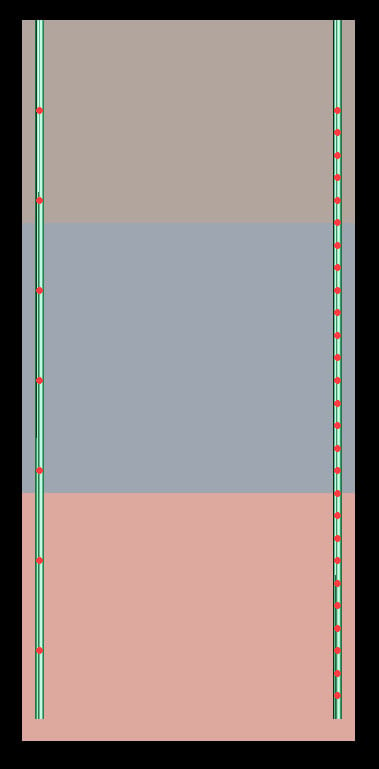
Figure 1: Layered ground with transmitter and receiver locations.
A 100 MHz sinusoidal excitation was applied and a single simulation was run. Time domain data was saved for each transmitter and receiver location. Transit time was then determined from these records, and graphs of COP and MOG were generated through scripting. Figure 2 shows the COP for each of the seven transmitter locations. Figure 3 shows an MOG graph for the transmitter located in the top layer and Figure 4 is an MOG graph for the transmitter located in the bottom layer.
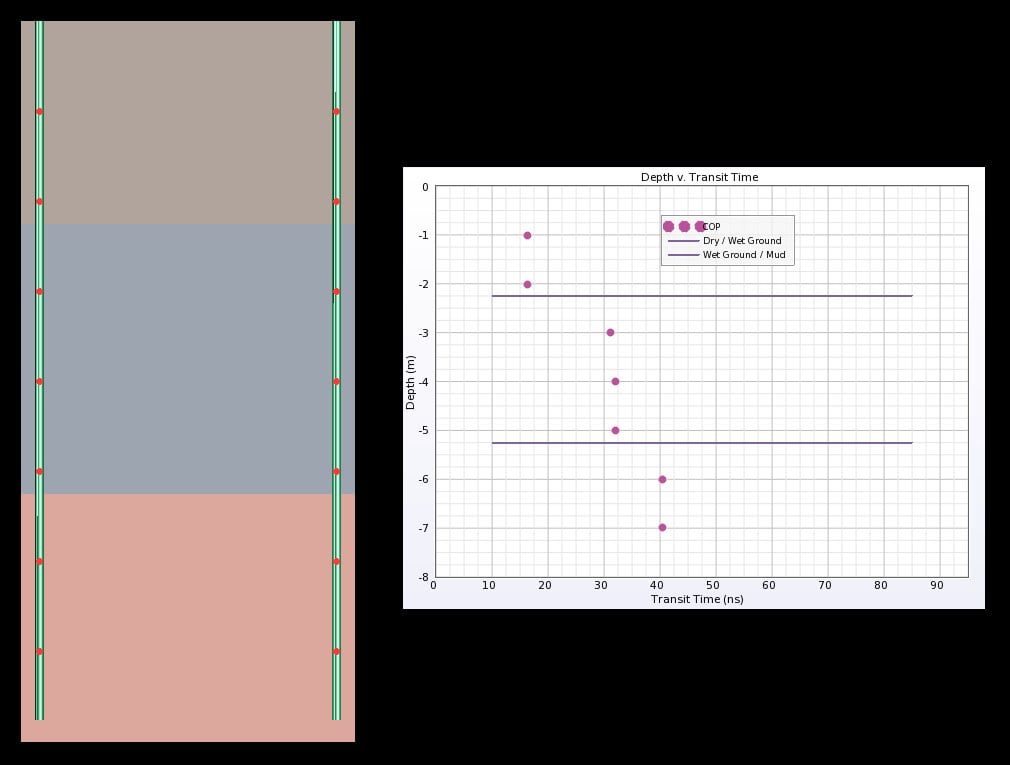
Figure 2: COP graph for all transmitter locations.
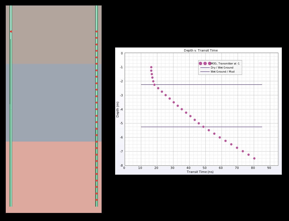
Figure 3: MOG graph for a transmitter located in the top layer.
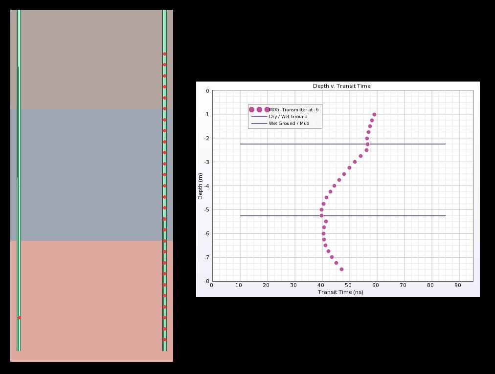
Figure 4: MOG graph for a transmitter located in the bottom layer.
A second simulation was run for the purposes of visualizing the electric fields as they propagated. Figure 5 shows the field distribution and MOG graph for the transmitter located in the middle layer. The field distribution output aids in understanding the effects of differing wave velocities on the MOG graph.
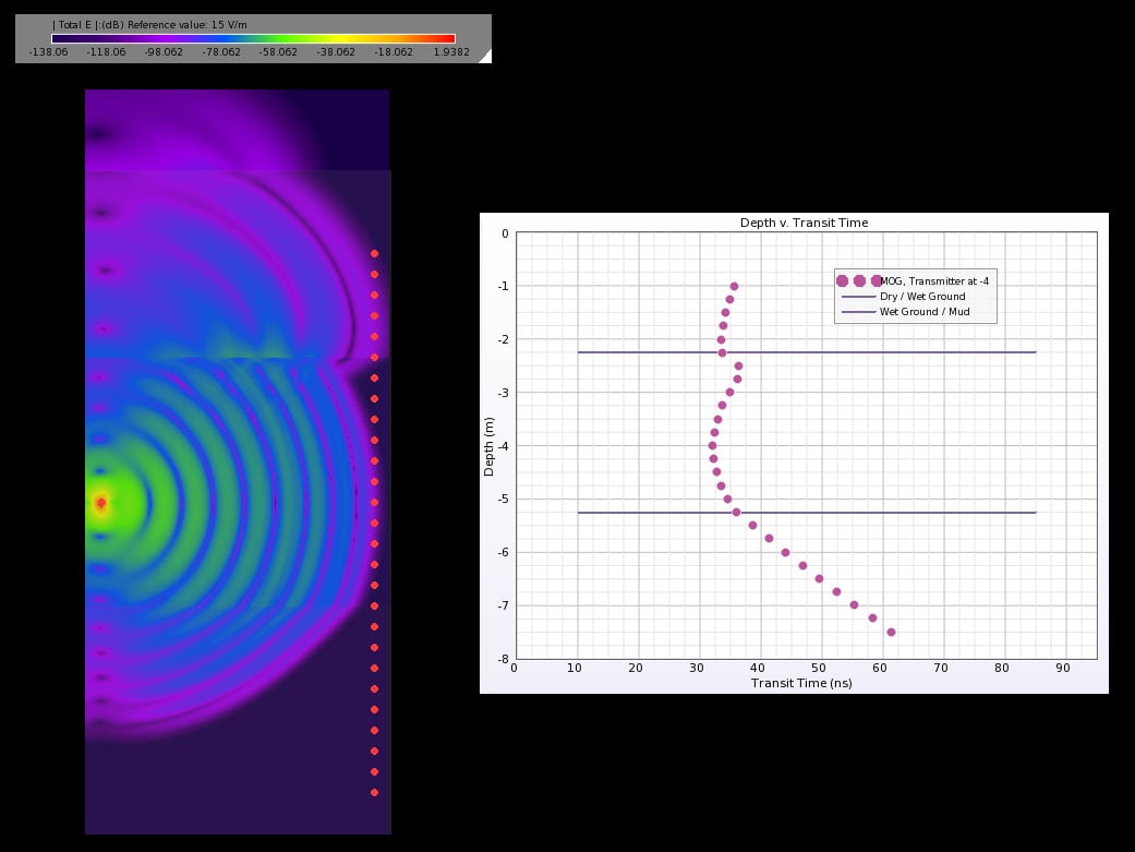
Figure 5: MOG graph and time domain electric field distribution for a transmitter located in the middle layer.
Request Project Files
Thank you for your interest in this application example. Please complete the form below to download the Analyze Crosshole Ground Penetrating Radar with Simulation Software project files.

